The Exhibition was opened on 2 August 2018 at the Warsaw Rising Museum. Now, its main part – the interactive map, presented at the Liberator Hall, has become one of the elements of the Main Exhibition.
In 2018, the 1944/Topography Exhibition has reached the finals of the European Design Awards.
The interactive map is based on 15 critical moments for the Rising – starting from the first days of the fighting, to key clashes to the capitulation. It shows the dynamic nature of the street fights – the changes in location of the Polish lines, directions of the German advance, Red Army positions and landing operations by the 1st Polish Army.
The map presents the sites of the greatest atrocities committed by the Germans, locations of allied supply airdrops and sewer routes used by the Insurgents to evacuate. It also features individual Insurgent redoubts and bastions of German resistance, and a German armoured train which bombarded the Polish positions.
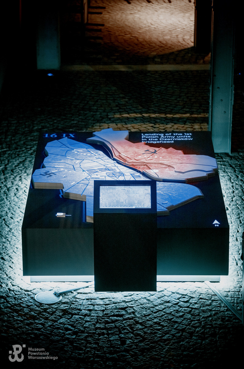
The red-and-white flags show the sites in which the Home Army and Rising Command stationed. Objects which went down in the history of the fighting are highlighted. Among them is the Tram Power Station, which today houses the Warsaw Rising Museum – a place where the memory of the Rising, one of the most important battles in Polish history, lives on.